RTK Facade & Slope Measurements with Millimeter Accuracy
Learn how our RTK drone facade and slope measurement case study delivered millimeter-accurate models directly imported into AutoCAD, saving time, eliminating rework, and enhancing safety.
RTK Facade & Slope Measurements with ±0.5 cm Accuracy
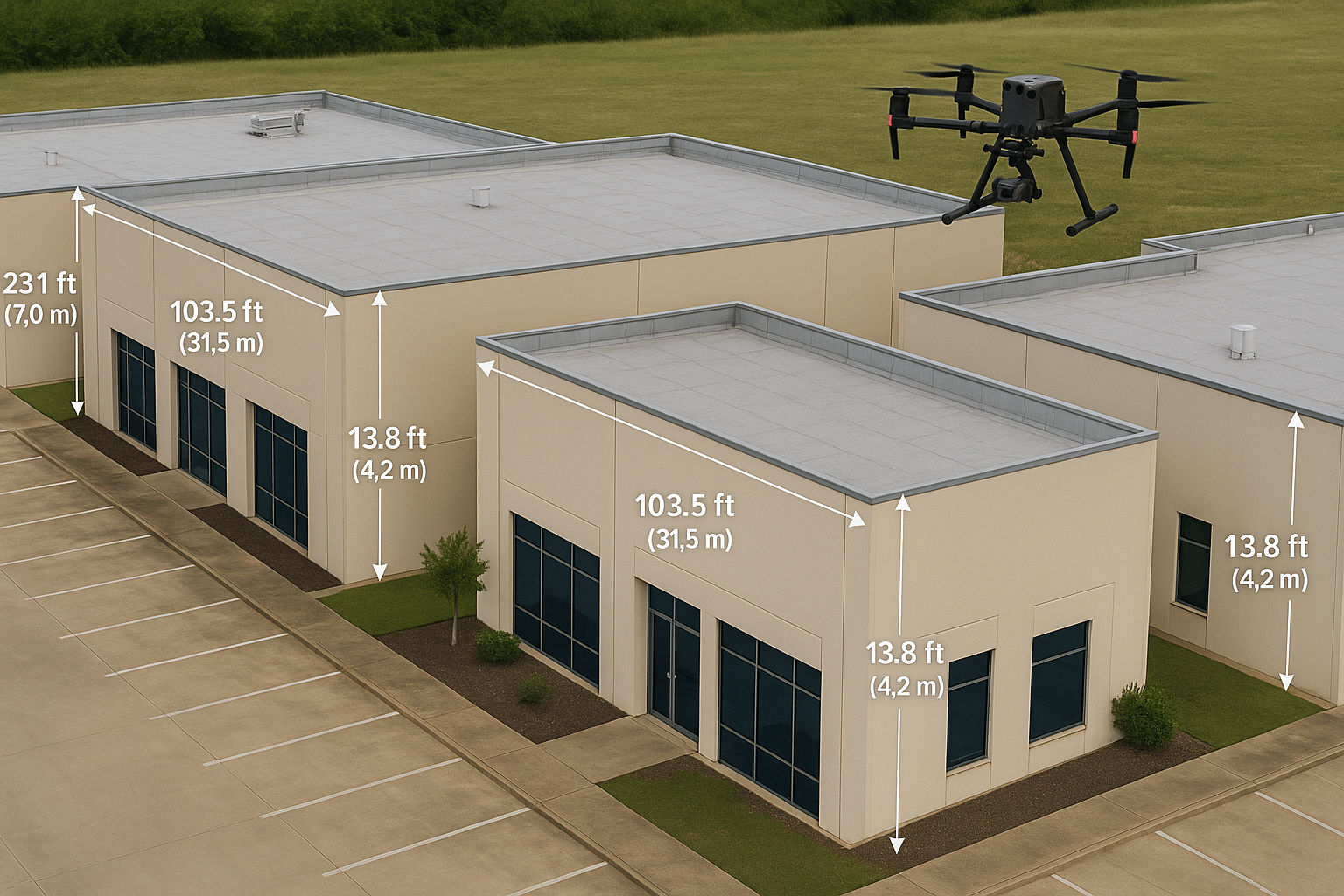
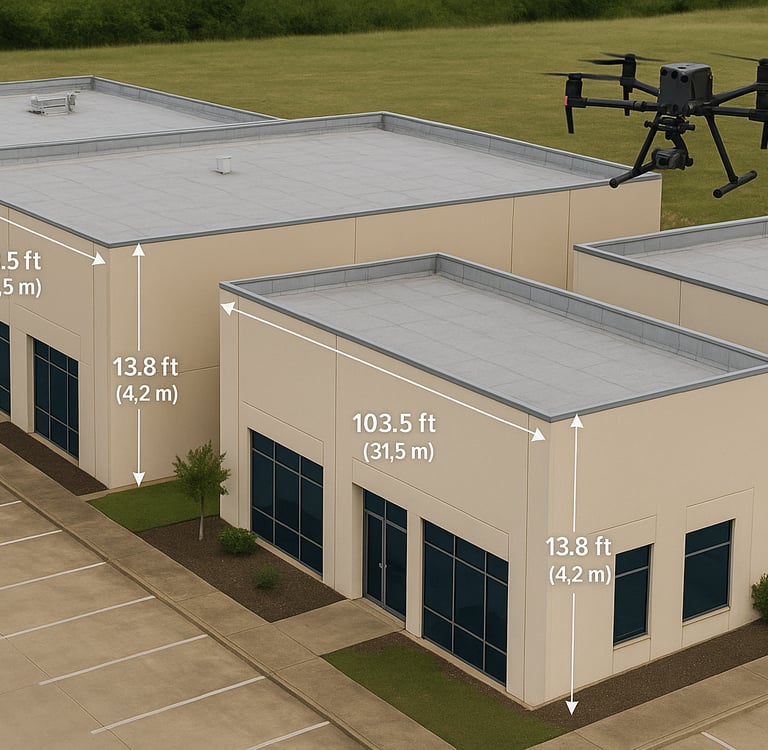
At Lumex Productions, we recently completed a detailed mapping project specifically focused on facade and slope measurements for a three-building expansion. Our goal was to provide exact dimensions for new awnings and fascia installations across multiple walls—delivered with ±0.5 cm accuracy using advanced RTK drone surveys.
Case Study Overview
Client
Commercial construction firm
Project Scope
Accurate and detailed models of a 3-building awning and fascia addon for a stadium
Objective
Obtain reliable measurements for architectural awning and fascia design and fabrication
Technology Used
DJI M4E with a DJI RTK-3 station
Challenges with Traditional Methods
Risk of Error
Manual tape measurements and photos often lead to inaccuracies and site reworks
Time-Consuming
Field crews can spend multiple days on-site for complete data capture
Safety Concerns
Personnel must access heights and uneven terrain, increasing risk
Our Solution
We began by deploying our RTK-enabled drone in a carefully planned flight pattern, capturing high-resolution images of building facades and slopes with real-time GPS corrections to ensure ±0.5 cm accuracy.
Once the data was collected, often in under an hour, we processed the imagery using DJI Terra to reconstruct an accurate, detailed 3D model. Our team then cleaned up the mesh, removed noise, and optimized the point cloud for precision. Within 24 hours of capture, we delivered the final model, which seamlessly imported into AutoCAD, so designers could immediately begin accurate awning and fascia design without the hassle of going through architectural designs and photos with manual tape measurements.
Project Outcomes & Benefits
Sub-Centimeter Accuracy
Eliminated measurement errors, ensuring precise installation of awnings and fascia
Time Savings
Reduced fieldwork from days to hours, accelerating project schedules
Zero Rework
Designers worked from accurate models, avoiding costly adjustment cycles
Enhanced Safety
Remote surveying eliminated dangerous climbs and manual measurements
Cost Efficiency
Lower labor and liability costs, with faster deliverables
Improved Workflow
Direct AutoCAD model import, streamlined design-to-construction
Why Choose Lumex Productions for Your Drone Needs?
At Lumex Productions, we provide professional, reliable drone services that elevate your event coverage to the next level:
Experienced, Certified, and Insured Pilots
Our team is FAA-certified and fully insured, ensuring your event is handled safely and professionally.
Tailored Solutions
Services customized for local businesses, municipalities, and real estate.
State-of-the-Art Equipment
Advanced drone technology for flawless results.
Dependable Service
From planning to execution, you can count on us to provide seamless, professional coverage every step of the way.
Fill out the form below to get started.
Lumex Productions
Setting new benchmarks in the industry with innovation, accuracy, and excellence.
Contact Us
469.444.7990
© 2026. All rights reserved.